Grainger Town Sculptural Map – Simon Watkinson, Tod Hanson 2003
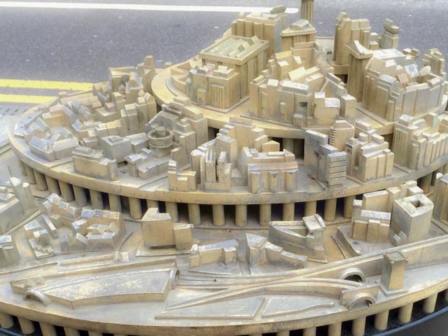
Displays Grainger Town as part of a layered city, from medieval to late Georgian classicism. Located on Neville Street, opposite Central Station. The map is a conceptual representation of the area of Newcastle known as Grainger Town. It is deliberately sited at the western entrance to the area, close to Central Station. The buildings and landmarks are reduced to their essential forms, so locals will be able to work out which is which and visitors will recognise them as they travel through the city.
More information TWSitelines